Visiting Family Sites in Ireland
Bob Gray, April 2018
In March 2018, I was fortunate enough to be in Ireland for a few days and took the opportunity to visit the areas where two of my great grandparents lived before coming to the United States. One trip was to Kanturk, County Cork where the O’Connell-Kennedy family lived. The second trip was primarily to Coolroe, County Carlow where the O’Brien-Kelly family lived but this trip included surrounding townlands as Coolroe is mostly farmland with only a few houses. The surrounding townlands included Ballynavortha, County Wicklow, as I identified it as a possible area where my great-great grandmother, Anna Kelly, may have lived before marrying William Brien, see “Update on the O’Brien-Kelly Family in County Carlow, Ireland.” My desire to find out about my mother’s family during their time in Ireland came directly from her. My mother’s fondness for her maternal grandparents is evident in an article, O’Brien Family History, she wrote in 1977. So, it is interesting that the two trips discussed here were to visit where her maternal grandparents lived prior to coming to the United States.
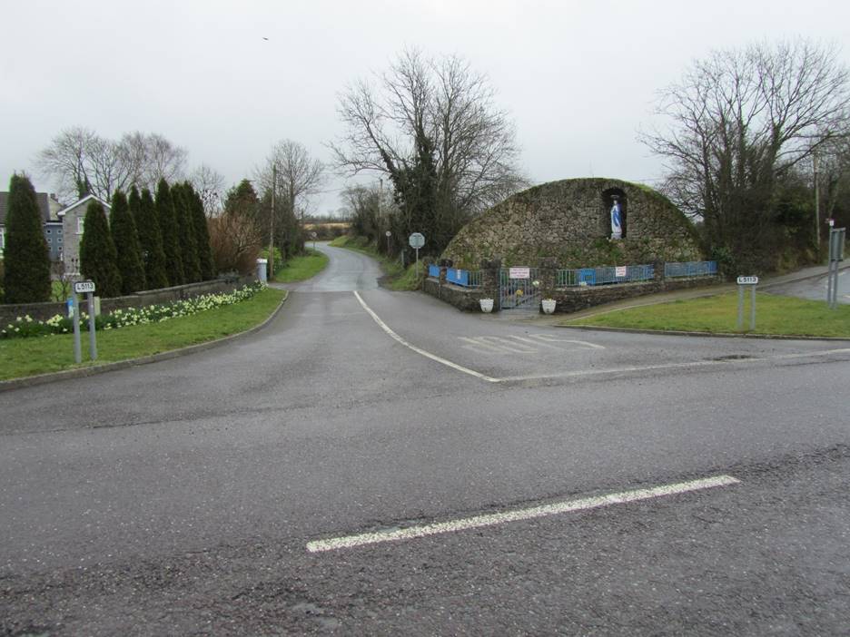
My great grandmother, Margaret O’Connell O’Brien was born in Bluepool, a part of Kanturk, County Cork, in 1849. We were staying in Dublin, so we took a train to Mallow, County Cork which is about 12 miles from Kanturk, and then hired a taxi to take us the rest of the way. Although I had spent many hours looking at maps of Kanturk, I found the town to be somewhat confusing. Part of my problem was the absence of street signs but, even if they were there, they may not have helped as many of the streets have been renamed. The fact that it was raining when we got there didn’t help. The biggest issue was the amount of traffic in the town. I found I could either watch for cars and trucks or look at where I was going, but I couldn’t do both. In reading the history of Kanturk by Patrick O’Sullivan, it seems the fact that Kanturk lies between several major cities was its key reason for existing. I marveled at the ability of tractor trailer truck divers being able to negotiate their way through town.
Our first stop was at a store to buy a hat to keep the rain off my head as I had neglected to bring mine. Our next stop was the Edel Quinn Hall as I thought I could buy the book on Kanturk history there. That proved to be incorrect, but the trip was worthwhile as there was an old aerial photograph of the town hanging in the hallway there. The photograph, shown below, was undated but my guess is it was taken around 1940 based on it being in black and white. Finding this photograph was a bonus as the local library is closed due to it being unsafe. I figured my only hope of finding old pictures was gone. Kanturk sits at the junction of two rivers, the Allow and the Dalua. The River Dalua is clearly visible in the photograph while the River Allow lies above and is only seen near their junction. The River Dalua continues on after its junction with the River Allow.
The photograph of Kanturk suffers from reflections from the glass covering the original picture. The area in the foreground is in the civil Parish of Clonfert. Bluepool lies to the north of the Dalua after the junction with the River Allow and is part of the Roman Catholic parish of Castlemagner. This is the area of interest as the O’Connell-Kennedy family lived in the Coorloe portion of Kanturk. The map after the photograph of Kanturk shows Bluepool and the location of the O’Connell-Kennedy family’s home. I have rotated the map to make it consistent with the photograph of Bluepool. The rotation has caused the house numbers to be on their side. The map is from the 1850 time period. It was included with the Tenement Valuation. The map indicates that the majority of the houses are class four with a few class three. Class four was the poorest condition for a house. This is probably part of the reason the houses are no longer present in the aerial photograph below. There was also a period of clearance in Ireland in the mid-1800s where estate owners decided it was better to remove the cottages and cabins for farm workers than to pay the taxes levied on them.
Based on their children’s baptism records, the O’Connells moved from Bluepool to the Greenane area sometime between December 1863 and September 1867. I assumed this move was related to the death of Johana Kennedy O’Connell’s mother, but it may have been brought on by the deteriorating condition or clearance of their house in Bluepool.
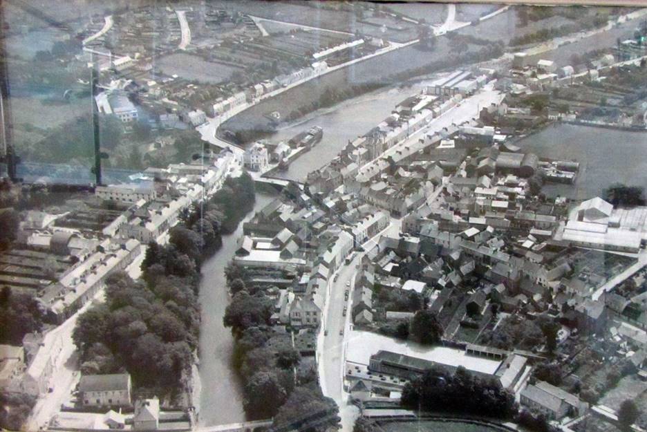
Aerial photograph of Kanturk, County Cork hanging in Edel Quinn Hall, c 1940. The O’Connell-Kennedy house was located in the upper right corner of the picture, between the road and the river in the area of the largest tree. Their house faced the road and there was a garden in the back.
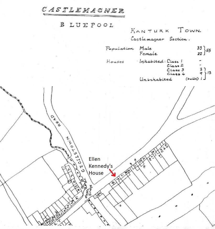
Ordnance Survey map published with the Tenement Valuation which was completed in 1953. This map probably predates the publication as there were more than 13 houses listed in the published document. Ellen Kennedy was the occupier of house number six and the immediate lessor of house number seven. This map covers the upper right corner of the photograph above.
The following pictures were taken on our way to the area where the O’Connell-Kennedy family lived. The first two are in the Greenane park along the River Dalua, looking west towards its junction with the River Allow and east. The next two photographs are of the shops and houses across the street from Greenane Park. Just before Cecilstown Road across from the park is a row of cottages that date back to 1860. These cottages, called the Darell Cottages, are probably the oldest houses in the Bluepool area. Their construction is not believed to be representative of the construction of the house the O’Connell-Kennedy family lived in.
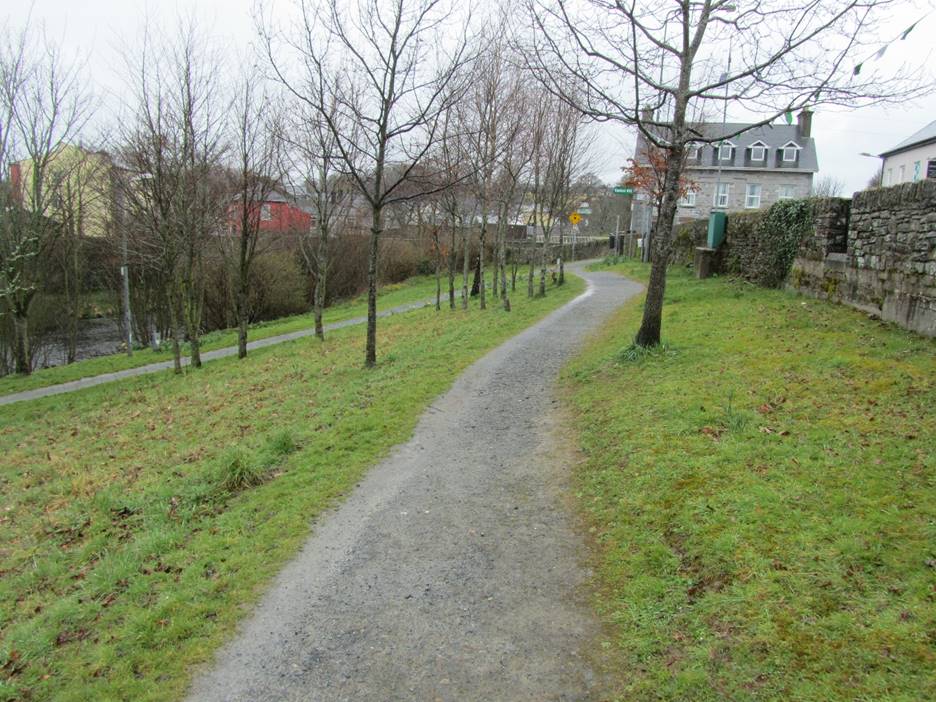
Greenane Park looking west towards the junction of the River Allow and River Dalua.
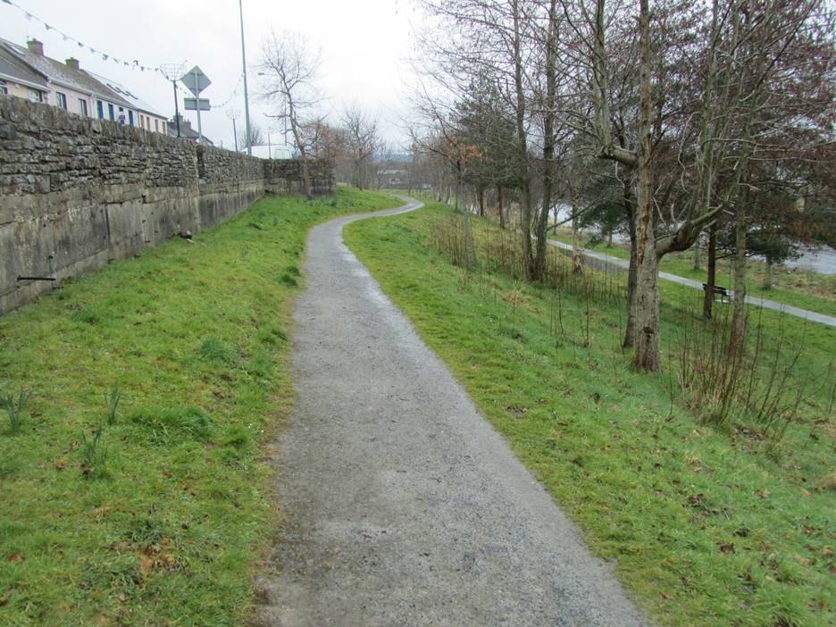
Greeenane Park looking east towards the area in Bluepool where the O’Connell-Kennedy family lived.
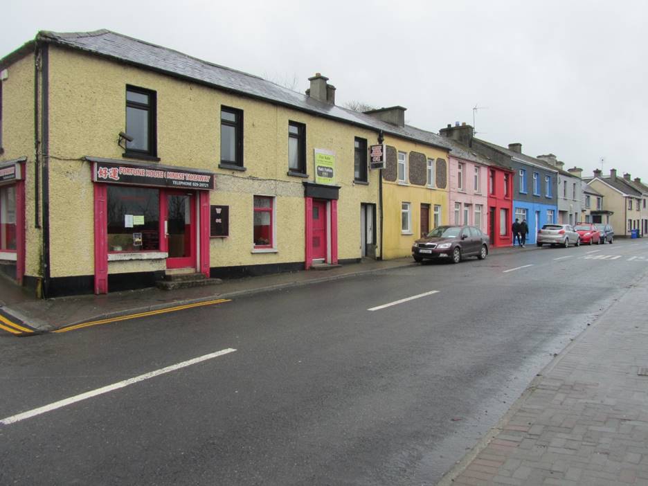
Shops across the street from Greenane Park.
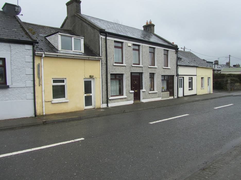
Houses across the street from Greenane Park.
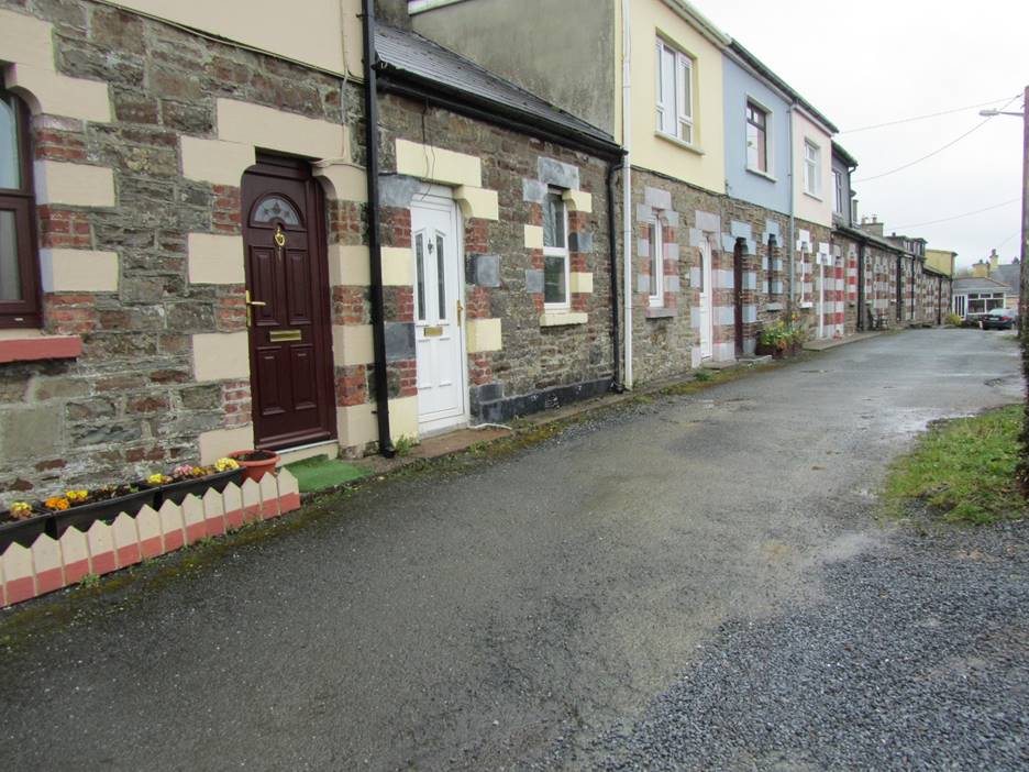
Some of the oldest buildings in the Bluepool area are the Darell Cottages built around 1860.
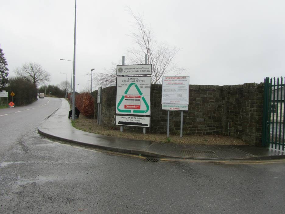
The section of Bluepool where the O’Connell-Kennedy family lived is now a recycling center.
Looking across Greenane Street Lower up Cesilstown Road. The row of houses shown in the map above would have started behind me as I took this picture.
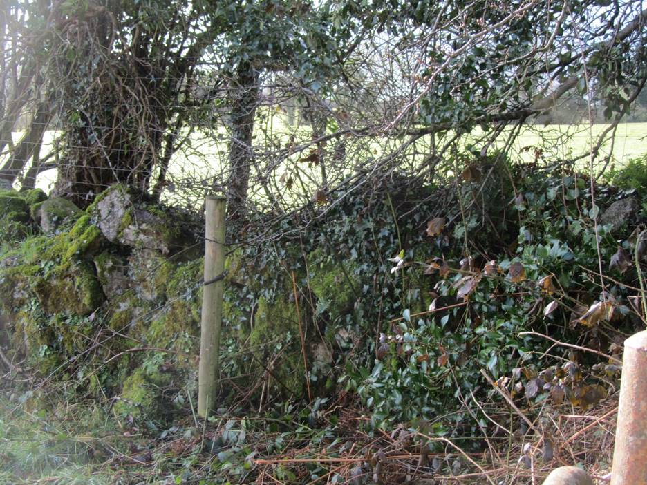
Greenane Street Lower showing the fence of the recycling center on the right. The O’Connell-Kennedy family lived about where the pole is next to the road.
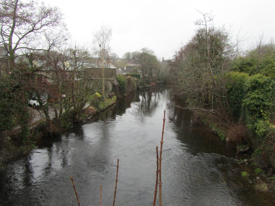
Photograph of the River Allow from the bridge connecting Kanturk with Bluepool.
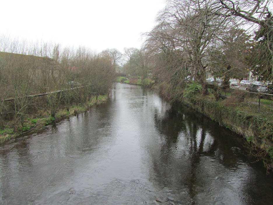
Photograph of the River Dalua taken from the bridge in Kanturk.
We closed out our day in the local bookstore buying a copy of Phillip O’Sullivan’s book on Kanturk. We then went to the pub next door and had a pint of Guinness while we waited for the taxi to collect us and take us back to the Mallow train station. The pub was a bit quirky as it had a store of sorts in the front and lots of little rooms for patrons to sit. My brother tells me the little rooms are called snugs.
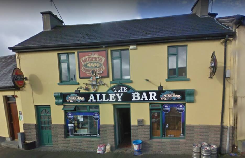
The Alley Bar in Kanturk, County Carlow.
In reading the book on Kanturk history, I found that there was a second famine period in the Kanturk area around 1870. The O’Connell’s immigrated to the United States sometime between December 1870 when their youngest son, James, was baptized and 1880 when they first appear in United States census records. I had wondered why they immigrated much later than the rest of my mother’s family and the reason may be the second famine was one too many for them.
I also found that the separation between Bluepool and Kanturk was more than just a difference in parishes. The part of Kanturk within the parish of Clonfert was owned by Lord Eggmont. Bluepool, including the portion of Kanturk north of the River Dalua was owned by the Reverend Charles Hyde Northcote. Reverend Northcote was the vicar of Clonfert, Church of Ireland. I also learned that there was a mill in Bluepool, near the Bluepool side of the bridge over the River Allow. Richard O’Connell listed his occupation as laborer in the New York and United States censuses. It is possible he or some of his family worked in the mill before it closed. The rest of Bluepool is farm and pasture land, making it possible he worked there as well.
Phillip O’Sullivan’s book has a chapter on the labor strikes that started around 1870. The Kanturk Laborers’ Club was founded in October 1869. A possible area for future study may be examination of the records of the Laborers’ Club and its successors, if they exist. Another is to search for records of Reverend Charles Hyde Northcote, who was the owner of the land in Bluepool. If Richard O’Connell worked on the estate or the mill, there may be record of his employment.
Our visit to Kanturk was enjoyable because all of the people we met were very pleasant and extremely helpful. We received excellent guidance from the various shopkeepers and one customer when we stopped to ask for help. Not a lot was learned from a genealogical standpoint but being able to say I was where my great grandmother and her parents and grandparents lived was well worth the effort.
Coolroe, County Carlow
My great grandfather, Thomas W. O’Brien, was born in Coolroe, County Carlow in 1850. Thomas met Margaret O’Connell in Dunkirk, New York where they were married in 1874. As discussed in The O’Brien-Kelly Family from County Carlow, Ireland, I found their house on an 1850s Ordnance Survey map. Using Google Street view, I knew the house was no longer there. My friend in Dublin, John Leonard, assured me that the stones from the house would still be somewhere nearby. “This is Ireland” he said. “They would have just pushed the stones from the house to one side, not loaded them up and carted them off.” So, even though I knew I wouldn’t see the house I had some hope for finding a pile of stones somewhere.
Visiting Coolroe, County Carlow was a bit more complicated that visiting Kanturk, County Cork as Coolroe is a farming area of County Carlow. I had arranged for a local tour guide to take us to Coolroe and the surrounding area, including Clonegal where Thomas was baptized. We took a train from Dublin to the city of Carlow where our tour guide met us. As with Kanturk, I had spent a lot of time looking at maps of Coolroe, but it took awhile before I realized our tour guide had taken us to the wrong area of Coolroe. Fortunately, I had published GPS coordinates for the location of the O’Brien house and our guide was able to take us to where the O’Briens had lived. According to Google Maps, the road they lived on is now called Spratt’s Lane.
I’m going to skip ahead a bit and then return to the actual visit to Coolroe. We ended our day in County Carlow with a visit to the library in the city of Carlow. There, the librarian, an Accredited Genealogists Ireland Affiliate, Bernie Walsh, provided me with lots of information on Henry Bruen, the owner of the estate where William Brien worked as well as the Ordnance Survey map of Coolroe seen below. I have marked the location of Brien house on the map. The map below is of far superior quality to any of the other Ordnance Survey maps I have for the area (see The O’Brien-Kelly Family from County Carlow, Ireland and Update on the O’Brien-Kelly Family in County Carlow, Ireland). The legend at the bottom of the map says the scale of the map is six inches to one statute mile. The ruler provides distances in chains and perches. A chain is equal to 66 feet and there are four perches in a chain. The total length of the ruler is 80 chains (320 perches) which is 5,280 feet or one statue mile. In the expanded view of the map below (click on the map to see it full size), it is seen that there is a dotted line down the middle of Slater’s Lane that turns to the right at the Brien house. This dotted line marks the border of the townland of Coolroe with the townland of Ballynavortha. The reason for pointing this out is that the Brien house is marked as being where the townland marker turns to the right. The Google Satellite View below confirms the location is correct.
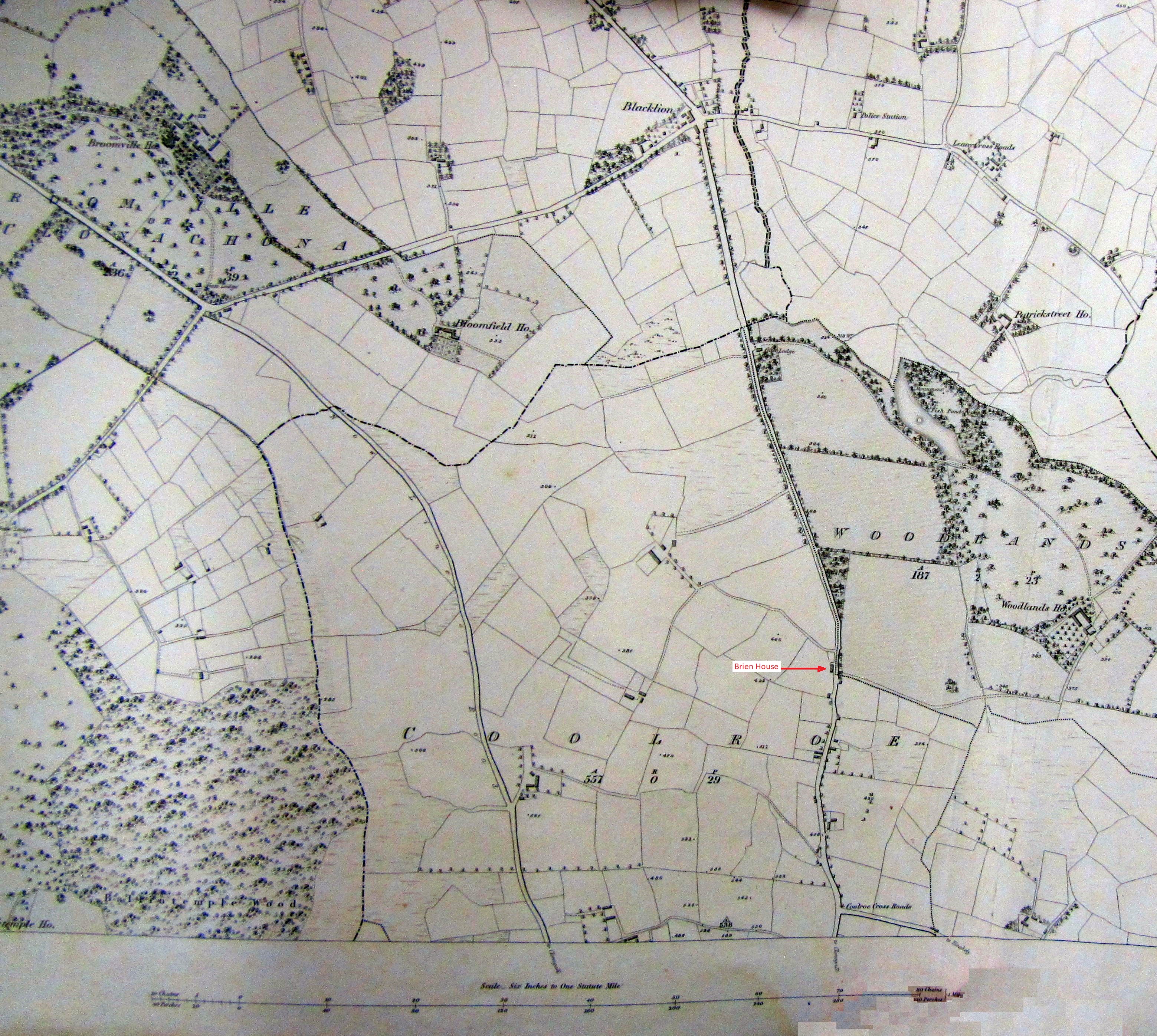
Ordnance Survey map of Coolroe, County Carlow, c. 1848. William Brien’s house is marked. Click on the map to expand. Use the back arrow on your browser to return to this page.
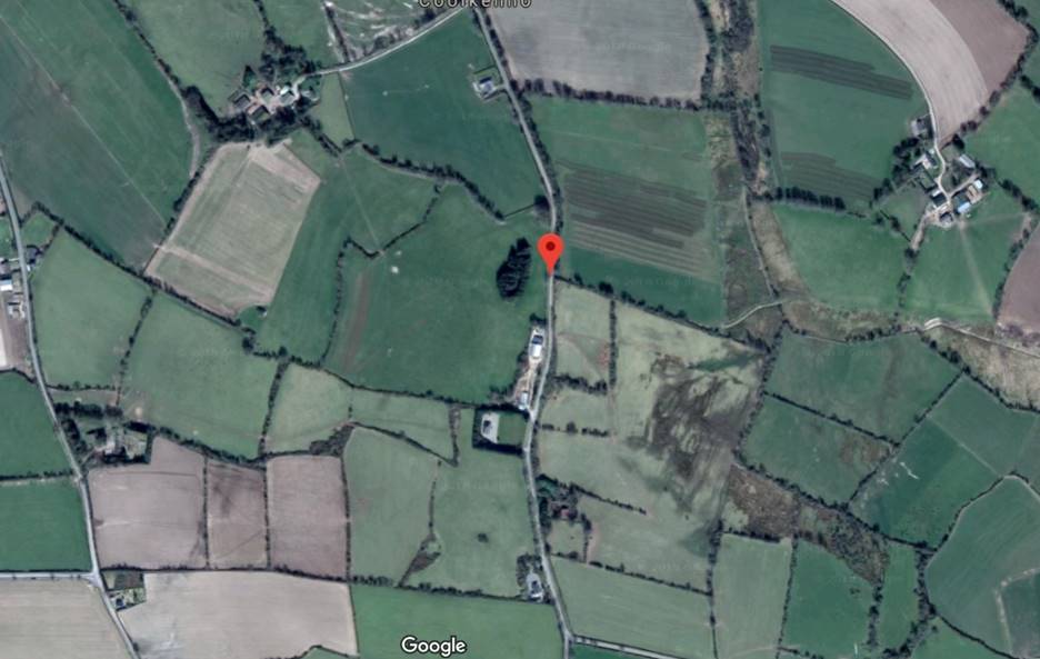
The red marker is at 52°44'22.2"N 6°39'49.6"W, which is where our tour guide took us. Comparing the Google Satellite View with the Ordnance Survey map above shows this to be the location of the Brien house. Some of the fields have different shapes, but others clearly have not changed in nearly 200 years.
The following pictures were taken during our visit to Coolroe, County Carlow. The first three are the area where the O’Brien’s house was located. The first picture is at the gate across the opening in the hedge which is where the map above indicates the Brien house once stood. As the picture shows, the gate is old, but probably not old enough to have been there since the 1850s. The large stone in the middle of the opening may have come from the Brien house. The stones in the next picture are also possible stones from the house. The third picture is of the clump of trees set back from the lane as seen in the Google Satellite View above. These trees are somewhat recent as the area is not shown as wooded in the 1850s Ordnance Survey map. Although rocks can be seen at the base of the trees, this area seems to far from the lane to have been the location of the Brien house. The next two pictures are looking north and south on Slater’s Lane from the location of the Brien house. Note the bend in the road looking north which is consistent with the Ordnance Survey map.
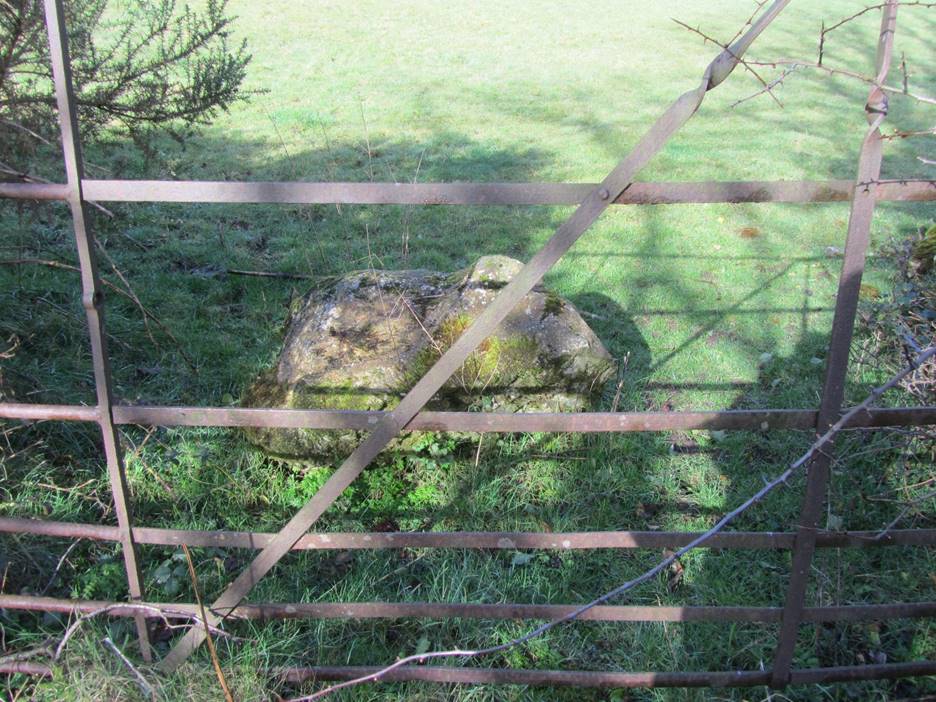
The gate at the entrance to the field where the O’Brien house was located based on Tenement Valuation records from 1852 and the associated Ordnance Survey map shown above.
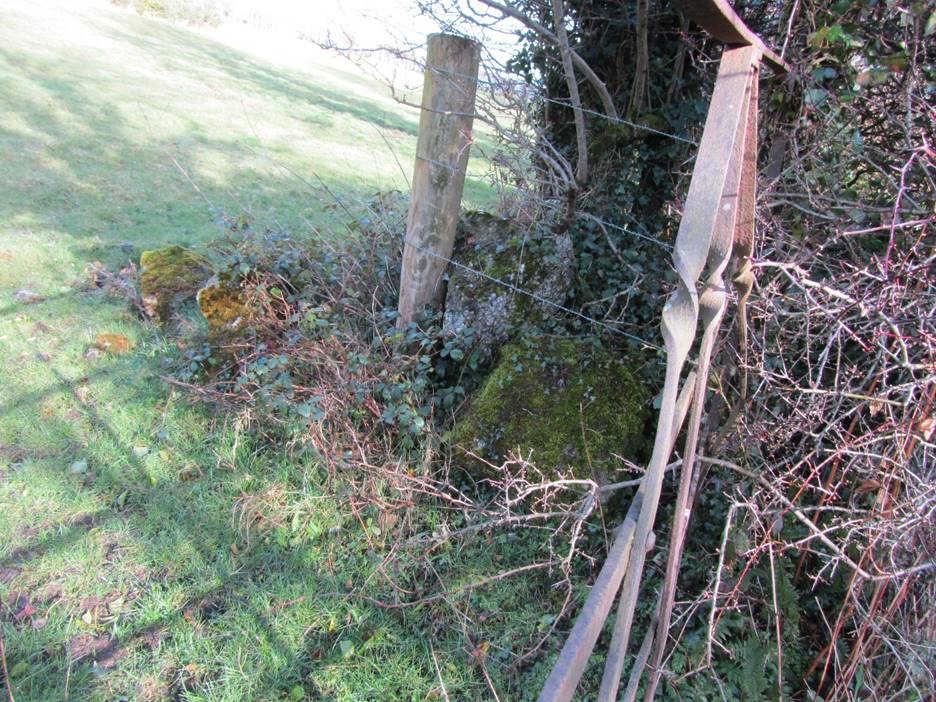
The area inside the gate shown above, looking north. Several more lose rocks are seen on the ground. These stones may have been part of the Brien house.
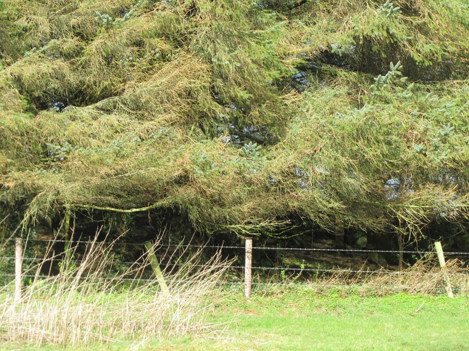
There is a stand of trees some feet back from the road. Several rocks are seen at the base of the trees. These may also have been part of the Brien House although the Ordnance Survey map indicates the house was much closer to the road.
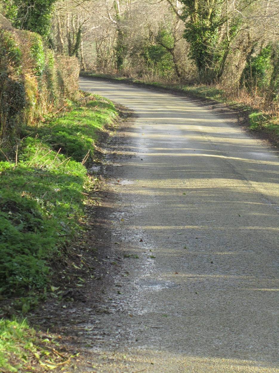
Looking north up Slater’s Lane from where the Brien house was located.
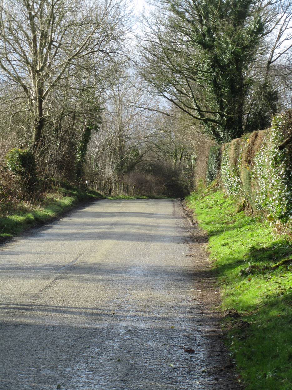
Looking south down Slater’s Lane from where the Brien house was located.
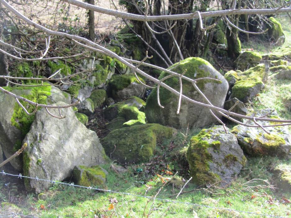
I then crossed the road to look for stones from the houses that once stood there according to the Tenement Valuation and the Ordnance Survey map. As you can see, there were many more stones visible on this side of the road. The Ordnance Survey map shows four buildings once occupied this area. Many of the stones looked to be part of a stone fence while others were just scattered about. These most likely came from the buildings that once stood here. They are of interest as an indicator of the type of construction that probably was used for the Brien house.
Directly across the road from where the Brien House stood. This used to be the entrance to a road leading to Ballynavortha.
A pile of rocks on the north side of the gate leading toward Ballynavortha. These stones may have once been part of one of the buildings shown on the Ordnance Survey map.
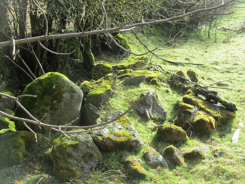
A pile of rocks on the south side of the gate leading toward Ballynavortha. These stones may have once been part of one of the buildings shown on the Ordnance Survey map.
I then asked our tour guide to take us to Ballynavortha as I have identified it as a possible childhood home of William Brien’s wife, Anna Kelly. Ballynavortha is less than a mile away using the lane across the road from the Brien house but we had to head north up Slater’s Lane in order to reach it. When we got to our turn, I asked the tour guide to stop for a minute to take photographs. The figure in the stone wall shone below had caught my eye. The second picture is a close up of the figure. The stone has writing on it, but we couldn’t make it out, although knowing the answer, my son pointed out that it said the Blacklion just like the sign below. I asked Bernie Walsh at the Carlow Library about the sign and she reported there used to be an inn or pub there called the Blacklion” Looking at the Ordnance Survey map, the crossroads were referred to as the Blacklion. This makes it highly likely that the Blacklion was William Brien’s local. It is less than a mile from his house. I have not been able to find out anything else about the Blacklion. It comes as no surprise that there used to be a police station nearby, see the Ordnance Survey map. The police were most likely British solders or British citizens. There are terrible stories of the oppression that the Irish were subjected to during the 1800s. According to the book, “Clonegal is 1798” pubs were a common gathering place for the Irish to meet and discuss what they could do about the British. The proximity of the police station was probably no accident.
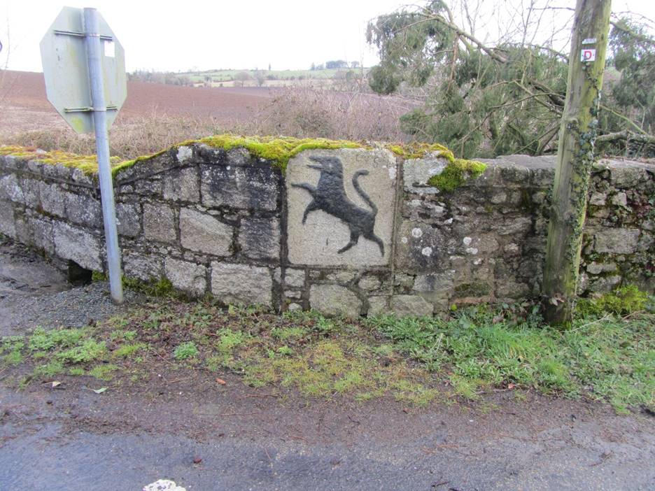
Stone wall with a Blacklion figure and inscription at the Blacklion crossroads. There once was a pub located here called the Blacklion.
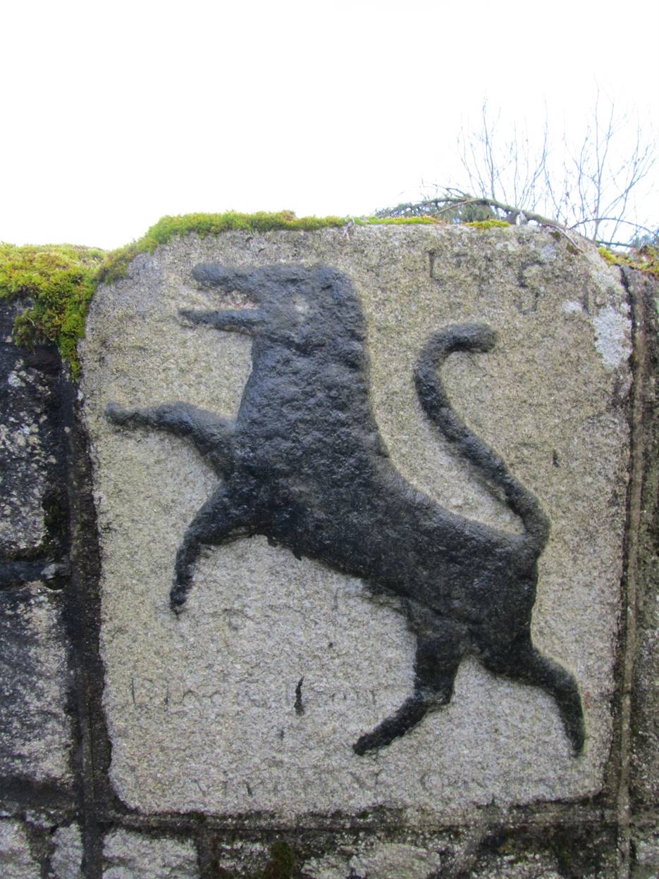
Close up of the Blacklion figure. The inscriptions says Blacklion and there is a date above that looks to be 17_5.
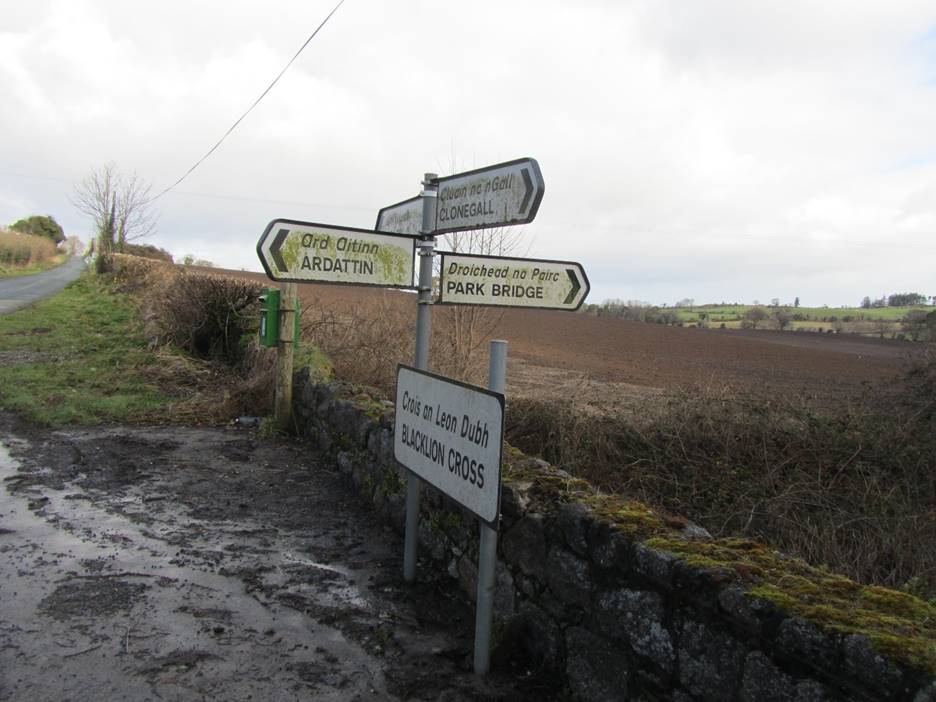
Sign posts at the Blacklion Crossroad.
Ballynavortha is even more desolate than Coolroe. We stopped at a spot roughly due east of the Brien house. There are very few houses in the area and they are not at all modern. The two pictures below show the fields looking towards the Brien house in Coolroe.
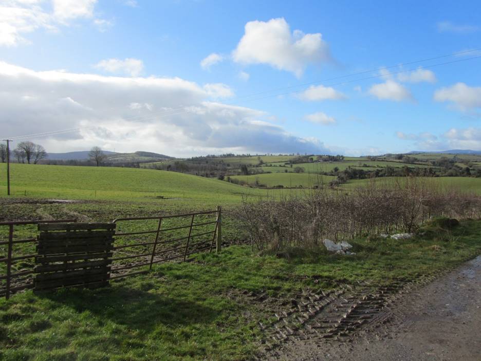
View from Ballynavortha looking west toward the Brien house.
View from Ballynavortha looking west toward the Brien house.
From Ballynavortha, we circled back past the Brien house and continued down Slater’s Lane to Clonegal. William Brien and Anna Kelly were married at the Roman Catholic Church in Clonegal and all of their children were baptized there. Bernie Wash said that Clonegal had to be Anna Kelly’s family parish as she would never have been married at another parish. Clonegal is very nice small town. Unlike Kanturk, there was little in the way of traffic and all of the buildings were well maintained. Of particular interest were the Weavers’ Cottages located near Saint Brigid’s Church. According to their web page, these cottages were built in the late 17th Century and were restored starting in 1999. We received an excellent tour of the cottages and it was explained that the construction of the cottages was superior to that which would have been used for common laborer’s cottages like the one William and Anna Brien lived in. The cottages would have had thatched roofs when first built but are now slated. As seen in the photograph of the front of the cottages, the exterior has a stucco like finish. The rear of one of the cottages, shown in the second picture below, had exposed stones. This is of interest as it shows the composition of the stone wall. When the cottages were restored, this wall was rebuilt using good mortar, but houses like the Brien’s lived in, would have something closer to mud with other materials mixed in. Comparing the size of the stones seen in wall below with the stones found near the site of Brien house, the stones in the wall are much smaller. The last photograph is of the garden in the rear of the Weaver’s Cottages. The weather had been cool enough that the garden had not been planted yet.
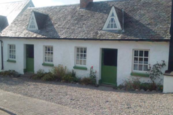
The Weaver’s Cottages in Clonegal.
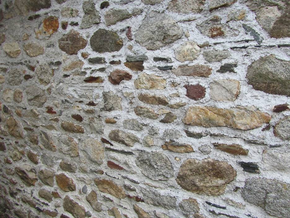
Exposed exterior wall of the Weavers’ Cottages showing the size of the stones used to construct the wall.
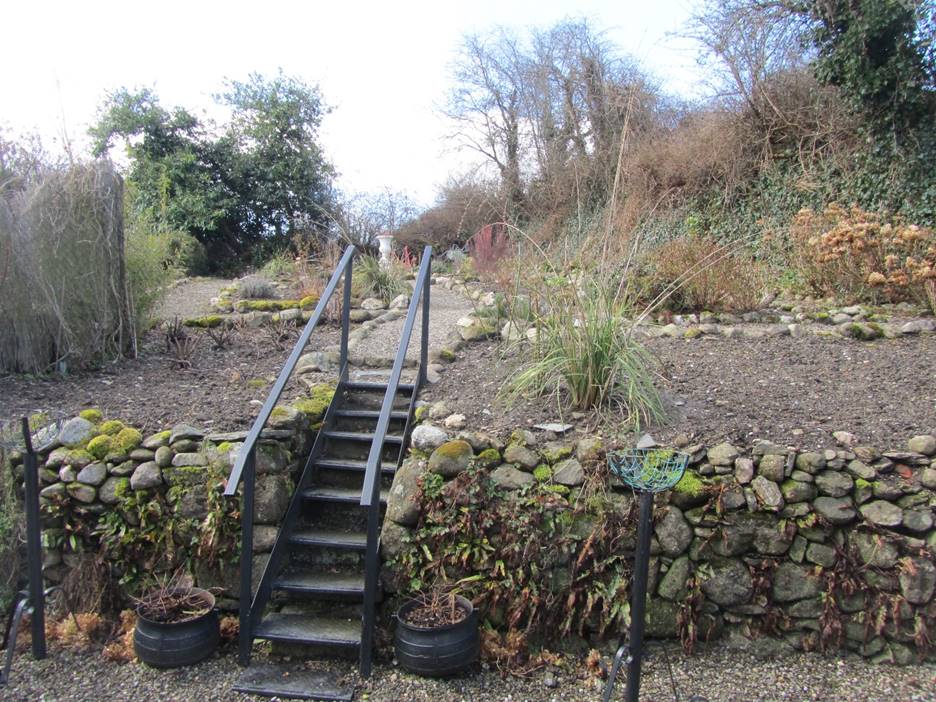
Garden area behind the Weavers’ Cottages.
When we left Clonegal, we drove through Lackabeg as there is a record for a Martin Kelly living there. Anna Kelly O’Brien’s death certificate identifies her father as Martin Kelly. We then headed back to the city of Carlow, stopping for lunch along the way. Back in Carlow, I met with Bernie Walsh at the library. Bernie went through many of the details I had for the O’Brien-Kelly family such as the size and construction of their house. When I told her about the locked gate in Coolroe, she said I should have climbed over it as “That’s what we would have done.”
The only new area identified for future research of the O’Brien-Kelly family is the Blacklion pub and the police station near it. As with our visit to Kanturk, not a lot was gained from a genealogical standpoint but it was very satisfying to have been able to visit where my great grandfather and his family lived in Ireland.
Home (including site search) | Bob Gray Consulting | Family History | Genealogy | Oswego Maps